Submarine Pipeline Project
CSR GeoSurveys Ltd. conducted a marine geophysical survey and geotechnical exploration program to support the engineering and design of a submarine pipeline project for a major energy supplier in Canada. The proposed submarine pipeline route is approximately 4 km and extends from approximately 5 m to 70 m water depth.
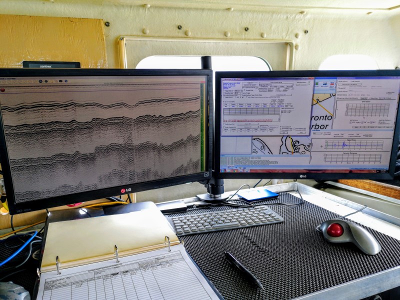
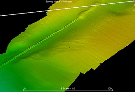
This project included the collection, processing and analysis of the following geophysical data.
- Chirp sub-bottom data (Klein 3310 Chirp)
- Boomer reflection sub-bottom data (Surface Tow/CSP-P 350J)
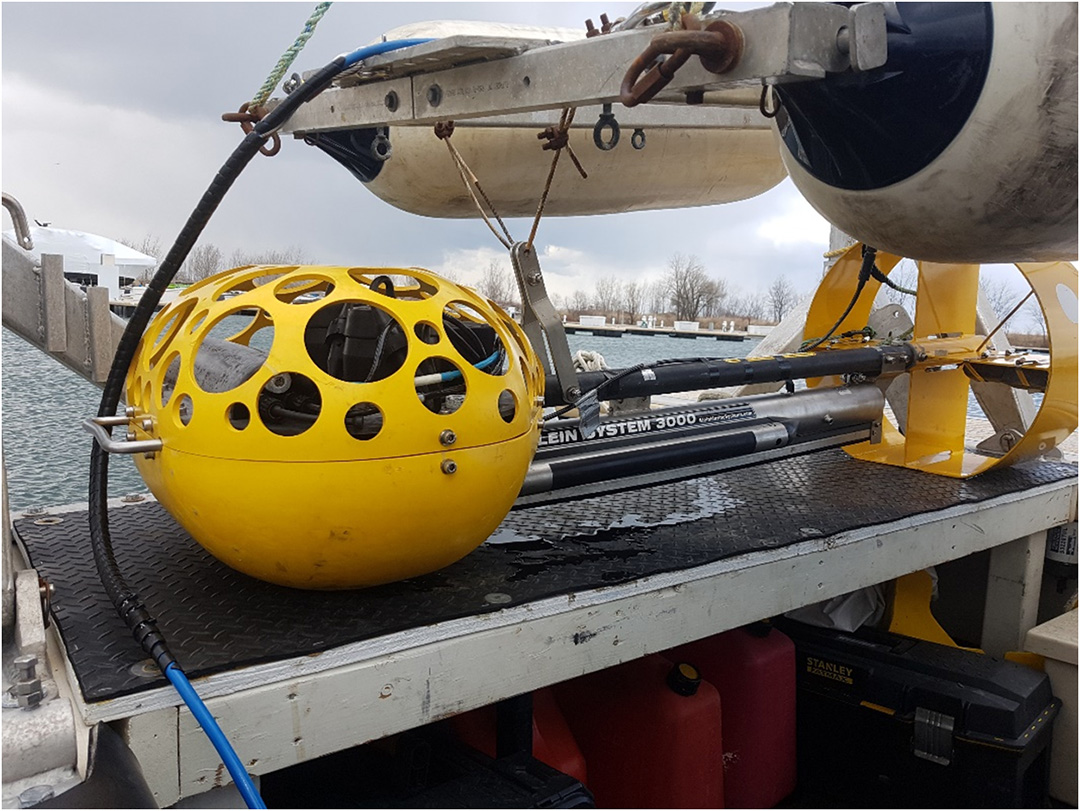
- Sidescan sonar data (Klein 3000)
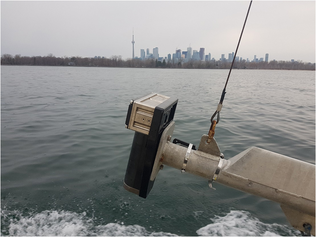
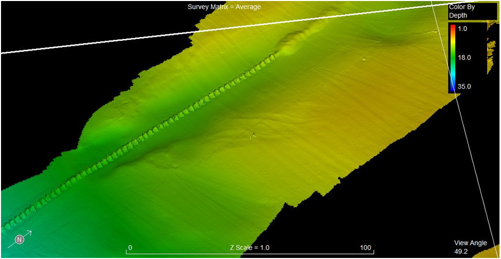
- Multibeam echosounder data (Reson T20P)
- Underwater Video transects
Gallery

This project also included the collection, field analysis/testing, and laboratory analysis of 9 vibracore samples (5 m cores).
Project Team
Project Manager – Glen Gilbert
Geotechnical Manager – Pat Campbell
Field Party Chief – Colin Toole
- Port Development Project, Montserrat
- Chukchi Shelf Regional Studies
- Submarine Cable Reinforcement Project
- Offshore Wind Turbine Project
- HVDC Submarine Power Cable Project
- Submarine Pipeline Project
- Sea of Okhotsk (Russian Arctic)
- Route Assessment Project, Chukchi Sea
- Resolute Bay (Canadian Arctic)
- Hydrographic Surveys, Halifax Harbour
- Wind Farm Submarine Cable Route
- Artificial Island Sediment Mobility Projects, Beaufort Sea