Damage Prevention
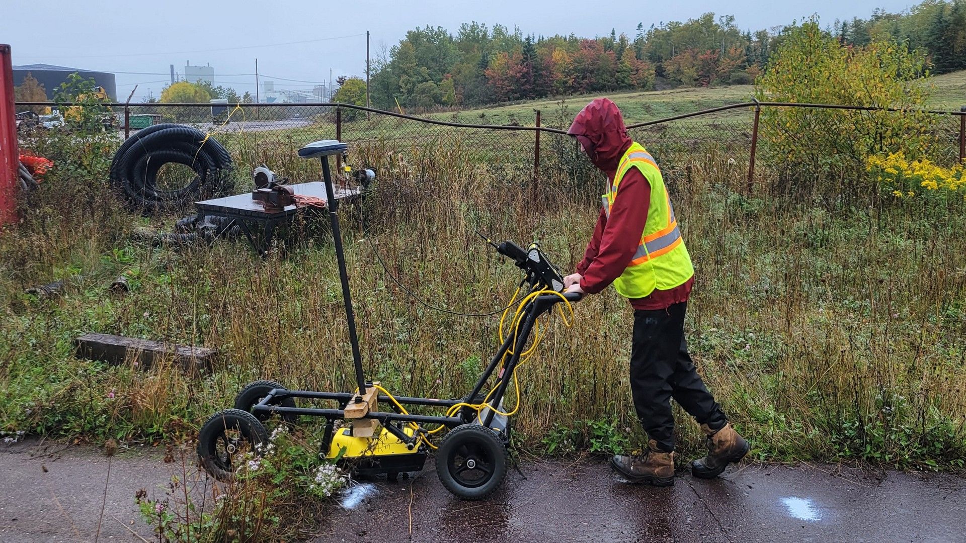
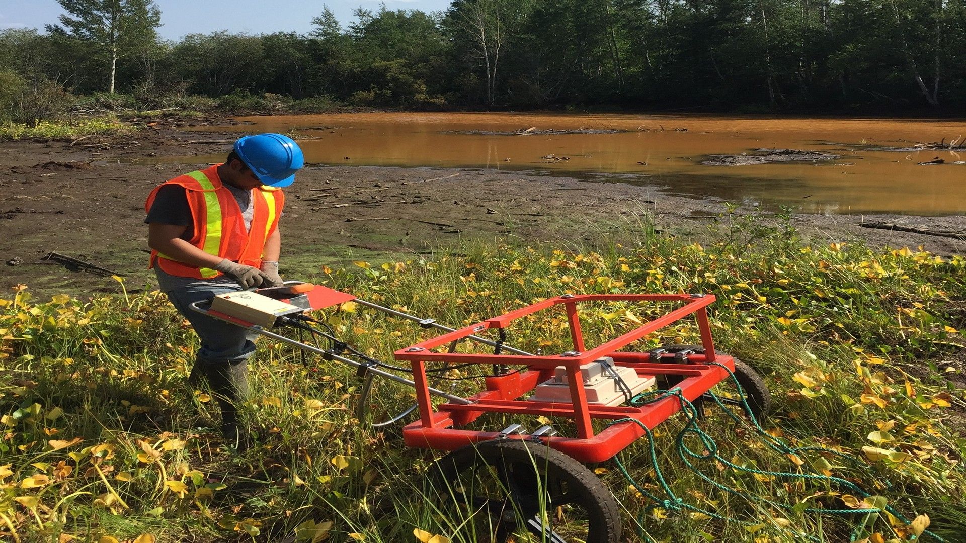
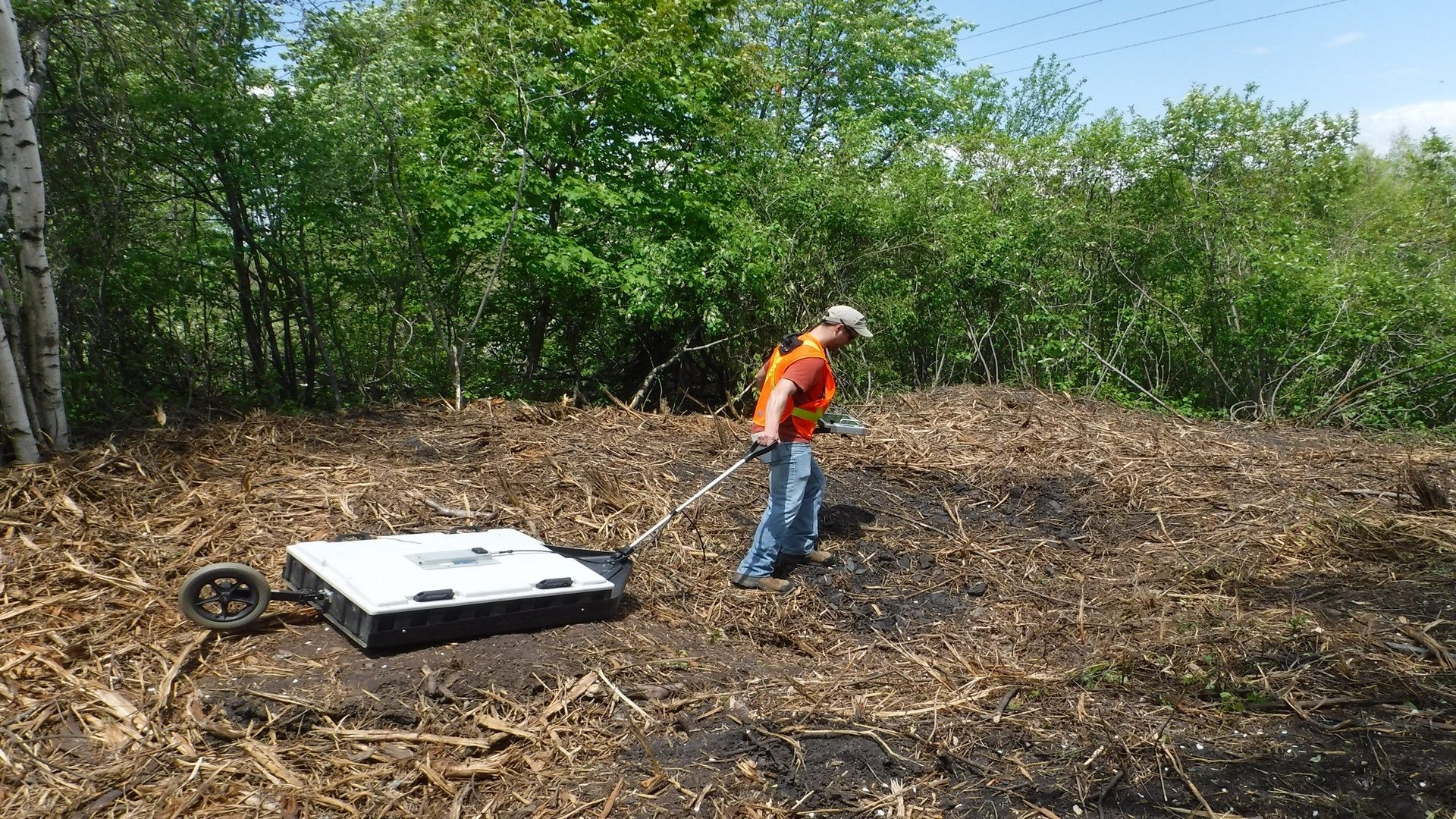
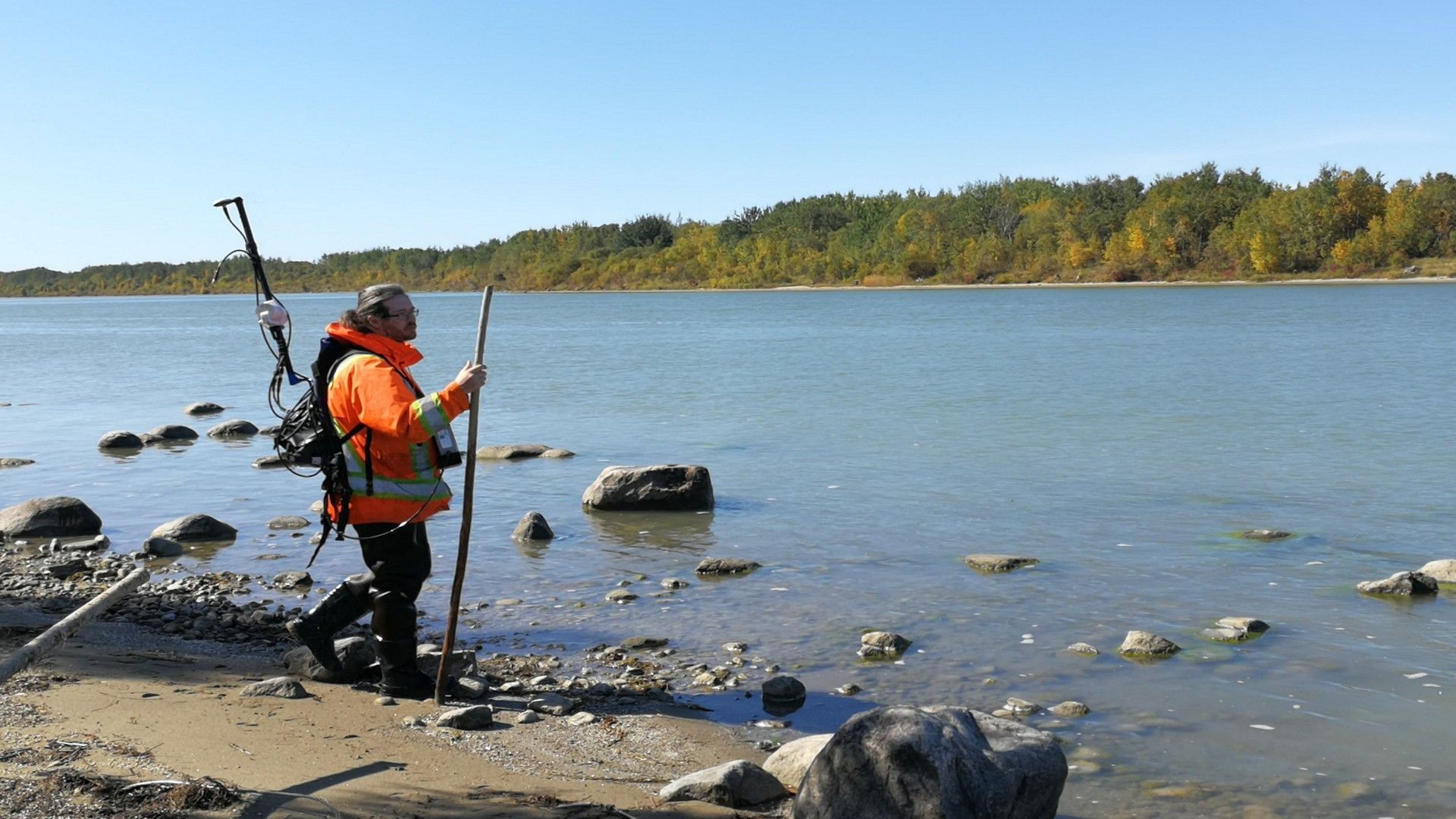
The geophysical industry employs multiple methodologies and techniques that can be used to identify and map buried facilities for damage prevention purposes that are not commonly associated with utility location. CSR GeoSurveys Ltd. specializes in utilizing technologies such as ground penetrating radar (GPR), magnetometry/gradiometry, and other non-traditional electromagnetic (EM) methods to identify and map buried facilities and structures that may present a hazard to the public or worksite.
Applications
- Concrete scanning with ground penetrating radar
- Identifying non-conductive, deep, or ungrounded utilities
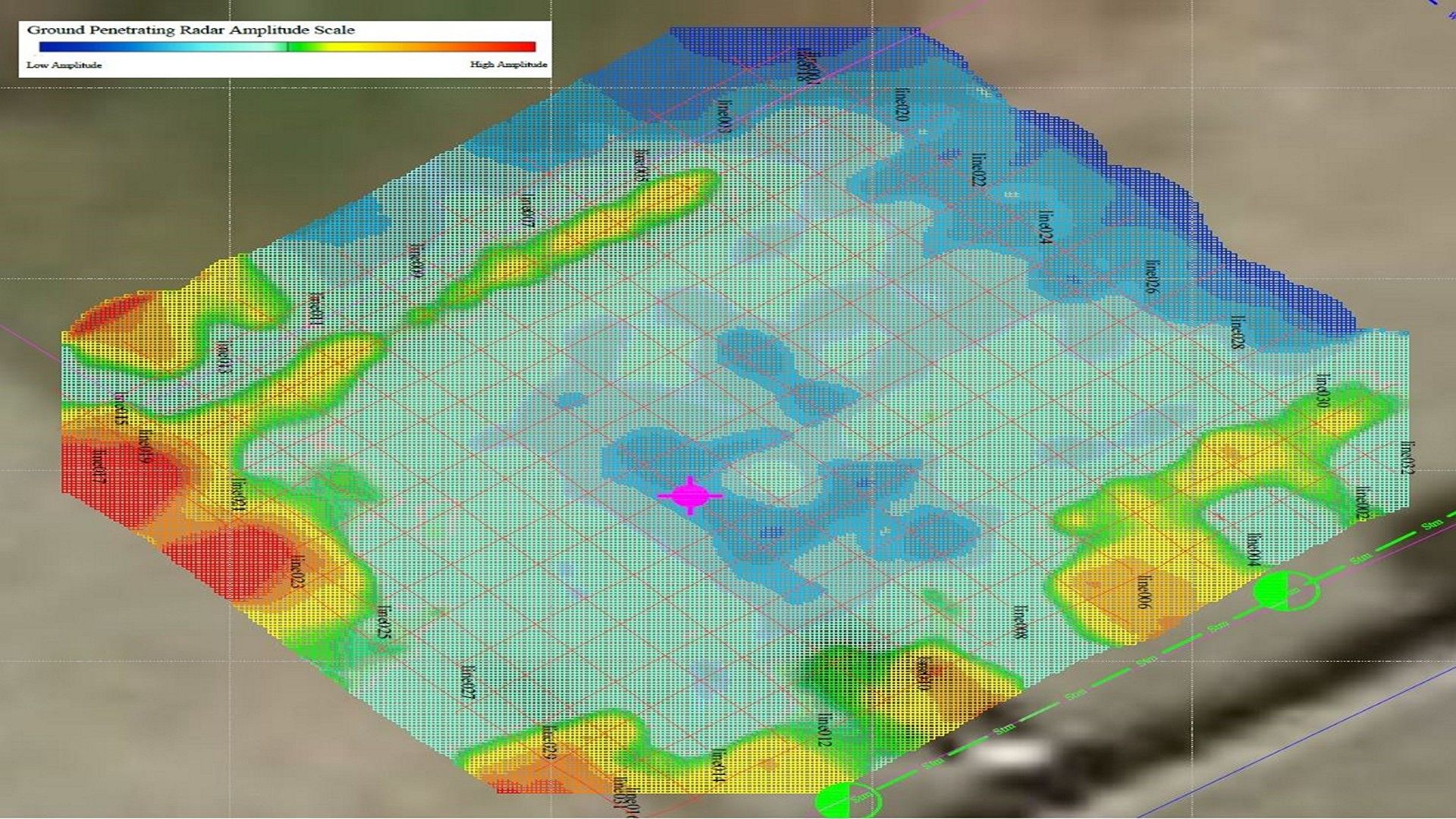
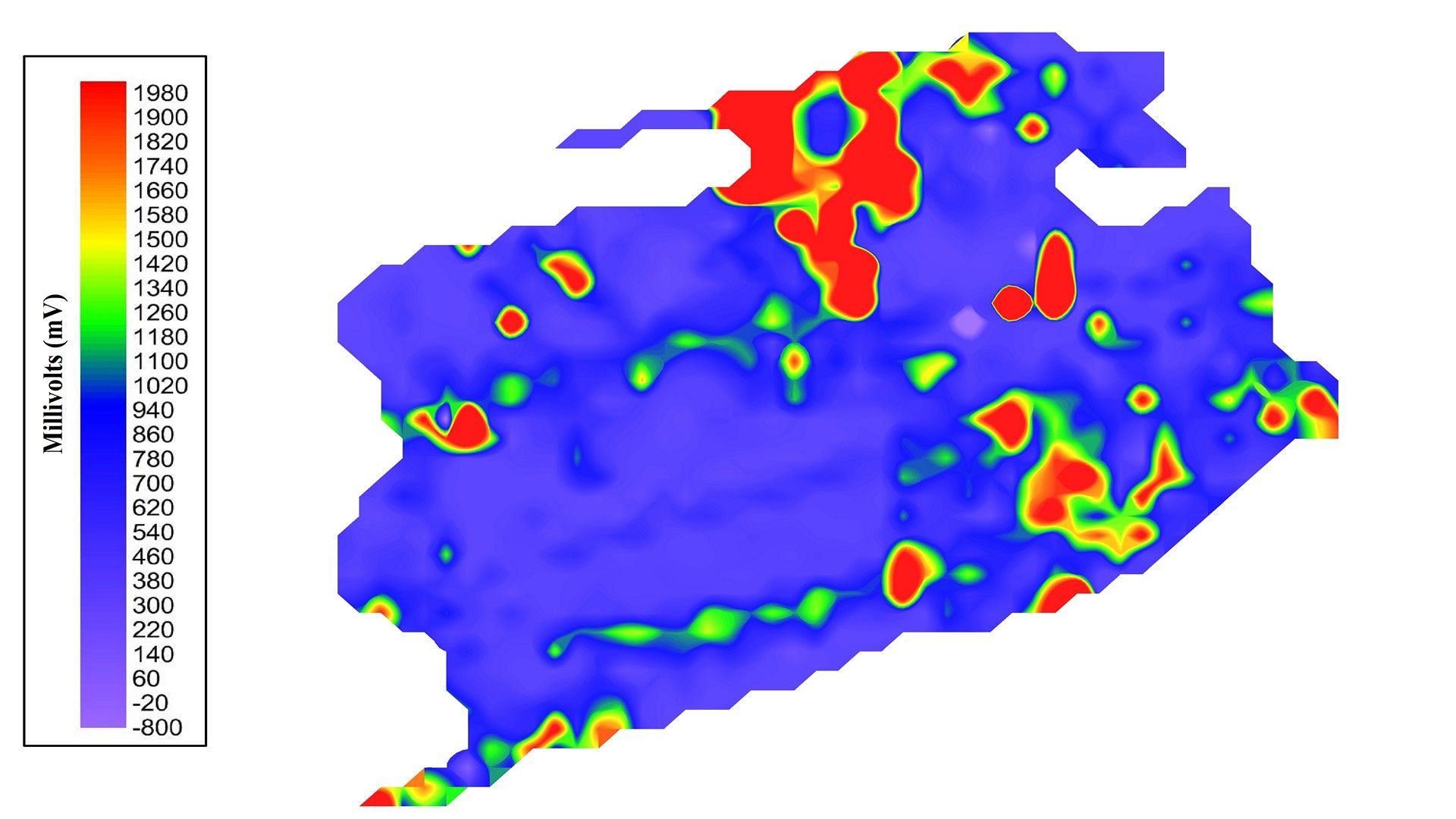
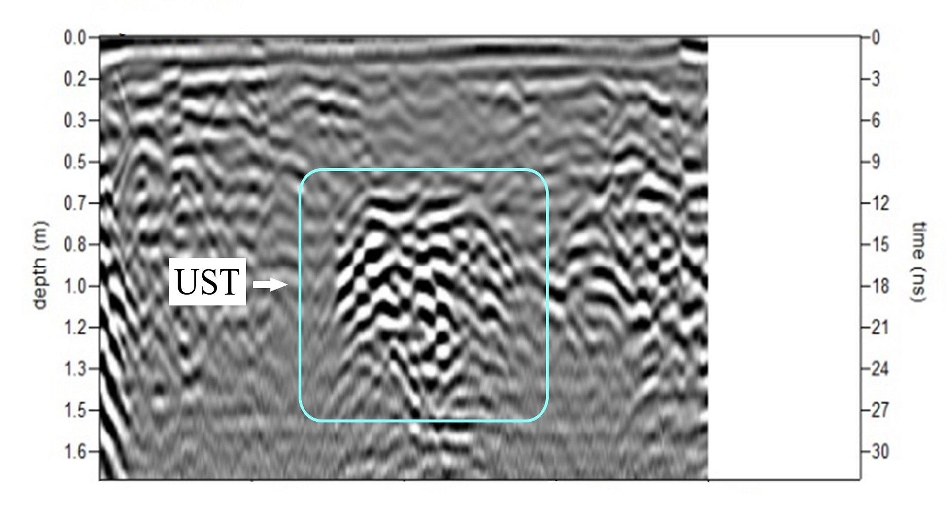
- Mapping locations of underground storage tanks (USTs)
- Delineation of buried foundations
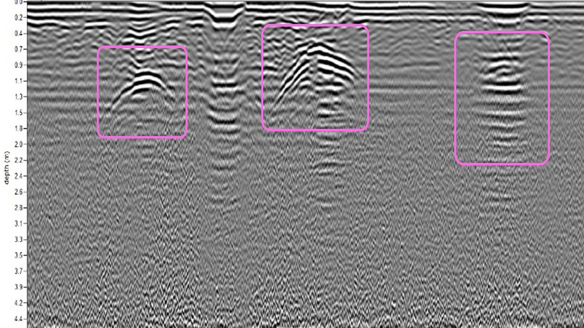
- Identification and mapping of unmarked burials and cemeteries
Gallery