Ice Scour Mapping & Analysis
CSR GeoSurveys Ltd. are recognized as a world leader in ice scour research, having conducted geophysical ice scour surveying and data analysis projects in the Chukchi Sea, Beaufort Sea, Grand Banks, Greenland, and Russia. Since our inception in 1985, we have completed over 90 ice scour mapping and data interpretation projects for the oil and gas industry, renewable energy developments, and scientific research.
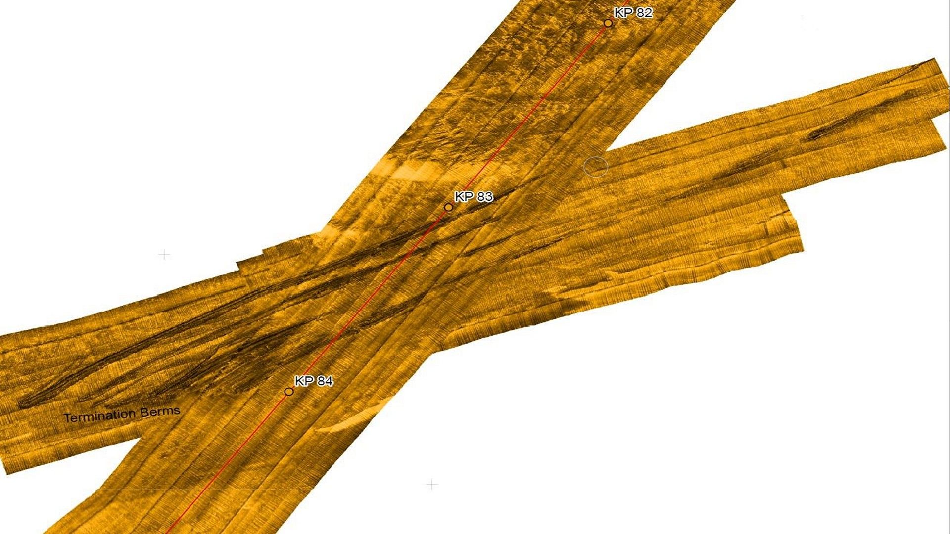
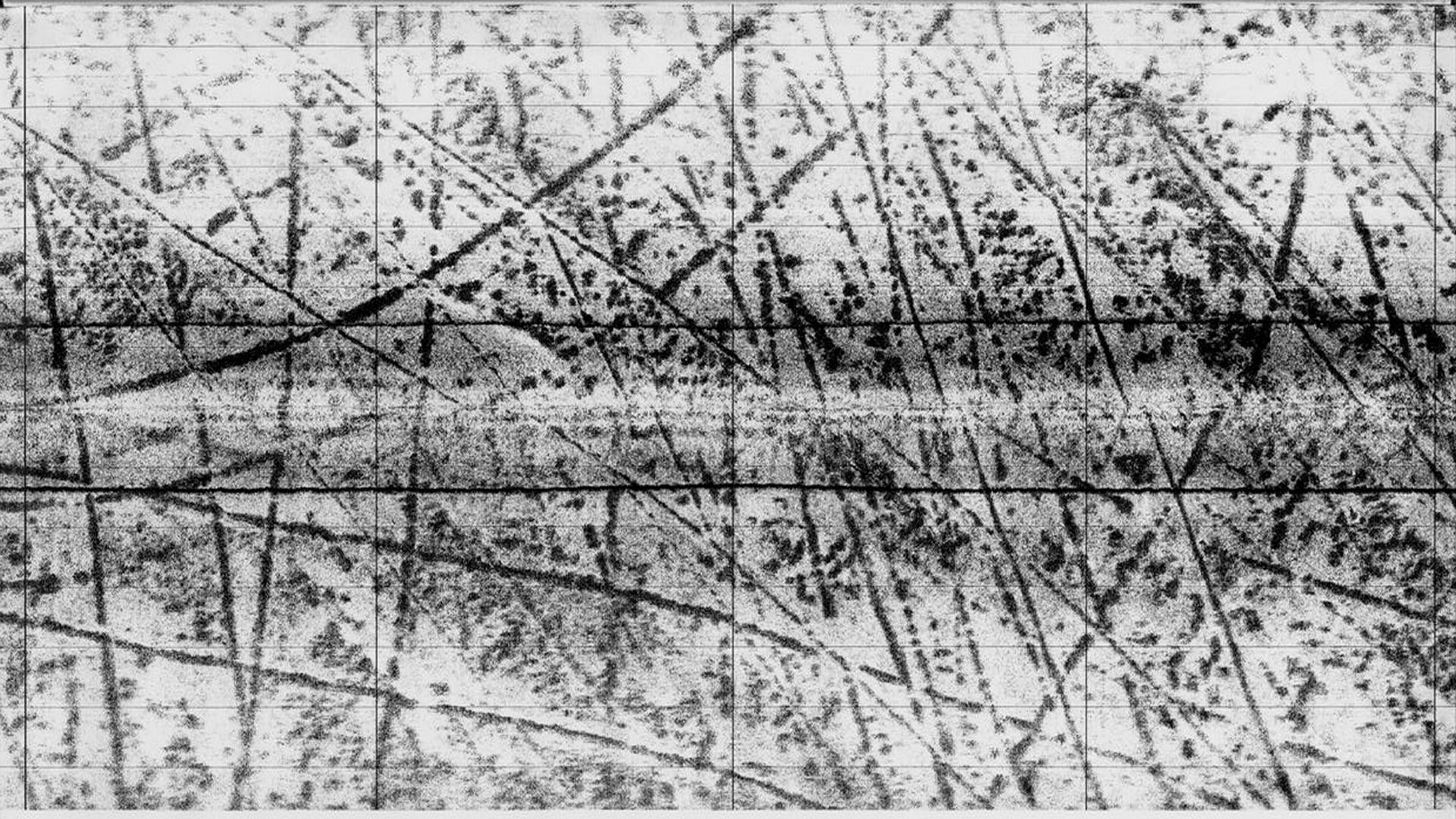
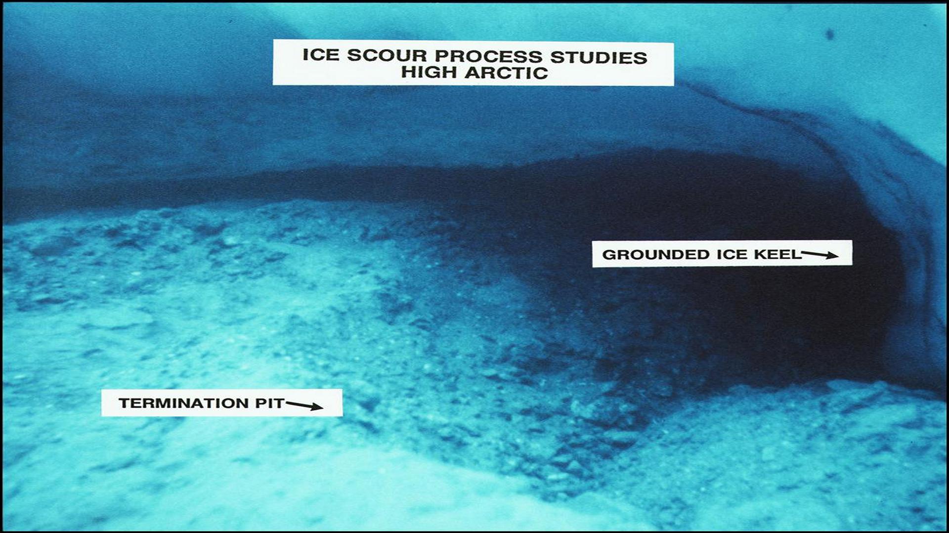
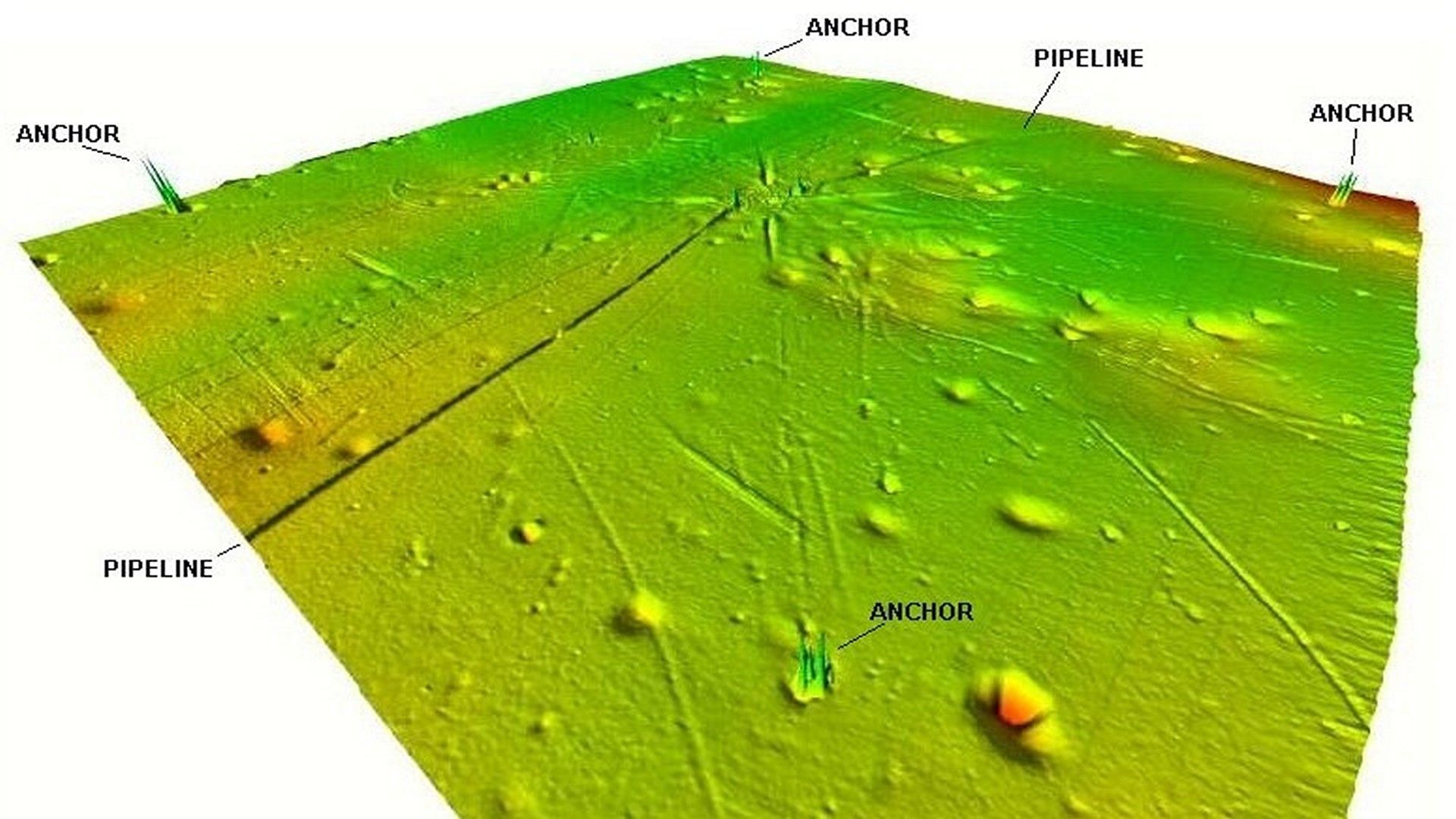
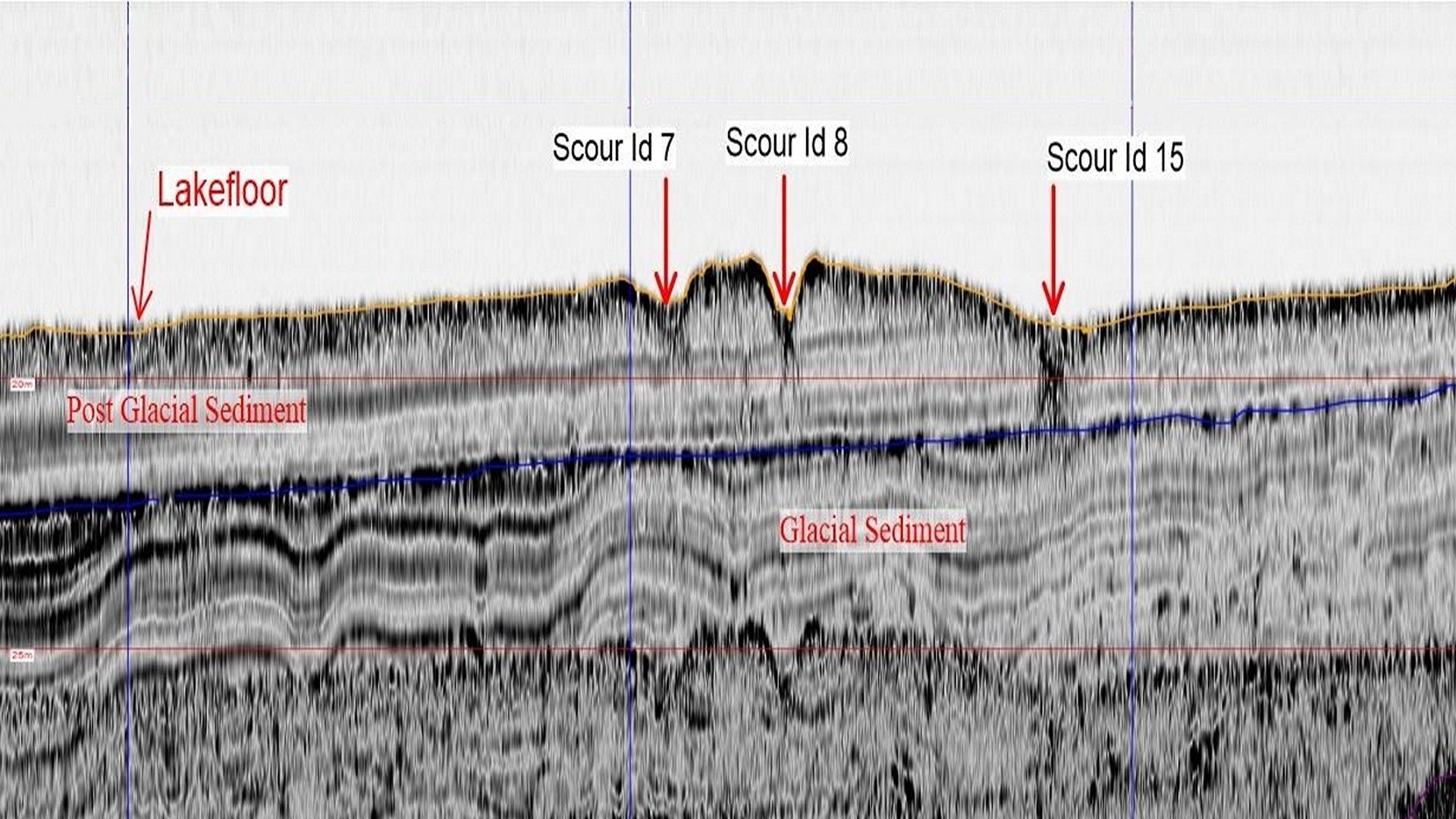
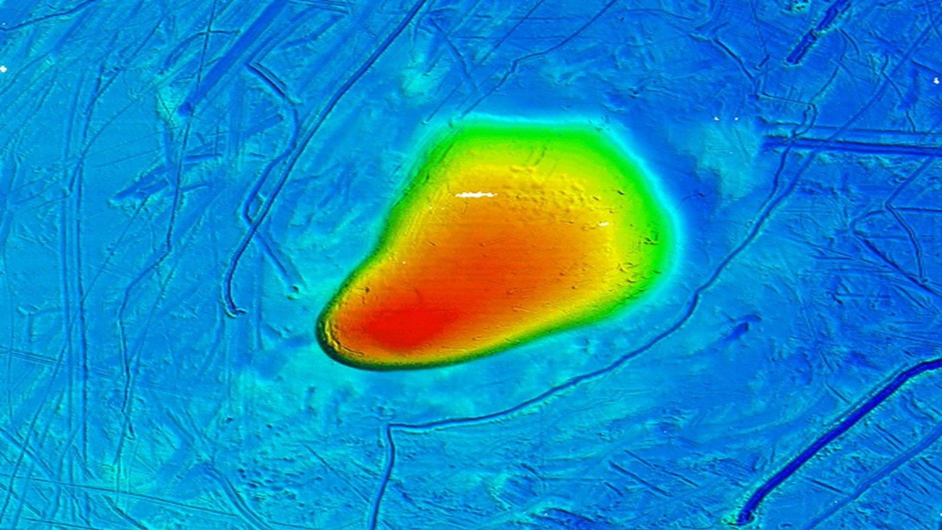
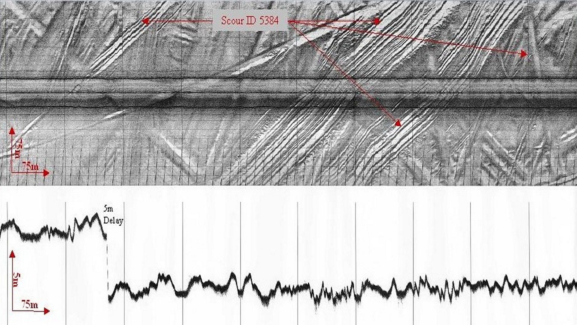
CSR specializes in acquiring and interpreting hydrographic and marine geophysical datasets for the purpose of ice scour interpretation, parameter mapping, and analysis. We digitize, database, and characterize identified ice scours to examine the relationships and draw correlations between scour parameters and environmental conditions, such as bathymetry and surficial geology.
Our ability to reduce, analyze, and model ice scour data provides our clients with an in depth understating of ice scour formation and the geological processes of scour degradation and erosion at their project site. This information is crucial for the planning and design of offshore engineering installations, including submarine cables and pipelines, drilling platforms, and wind turbine structures, that may be threatened by scouring.
- Ice Scour Geophysical Surveys
- Ice Scour Interpretation and Parameter Mapping
- Ice Scour Depth Profiling and Statistical Analysis
- Along Track Extreme Ice Scour Tracking
- Ice Scour Database Creation and Management
- Data Review and Desktop Study
- Ice Scour Frequency and Impact Statistics
- Seafloor Disturbance Modeling
- Pipeline Burial Modeling
Gallery
- Overview
- Pipeline & Cable Routing
- Dredging Support
- Navigation Safety & Charting
- Renewable Energy Developments
- Ghost Gear Locate & Recovery
- Ice Scour Mapping & Analysis
- Construction & Engineering Support
- Coastal Zone Mapping
- Port & Harbour Developments
- Geotechnical Investigations
- Environmental Mapping & Monitoring