Renewable Energy Developments
CSR GeoSurveys Ltd. is experienced in providing high quality hydrographic, marine geophysical, and geotechnical surveys for renewable energy developments. CSR has conducted surveys for offshore wind farms in Lake Michigan, Lake Erie, and Lake Ontario, and for tidal installations in the Bay of Fundy.
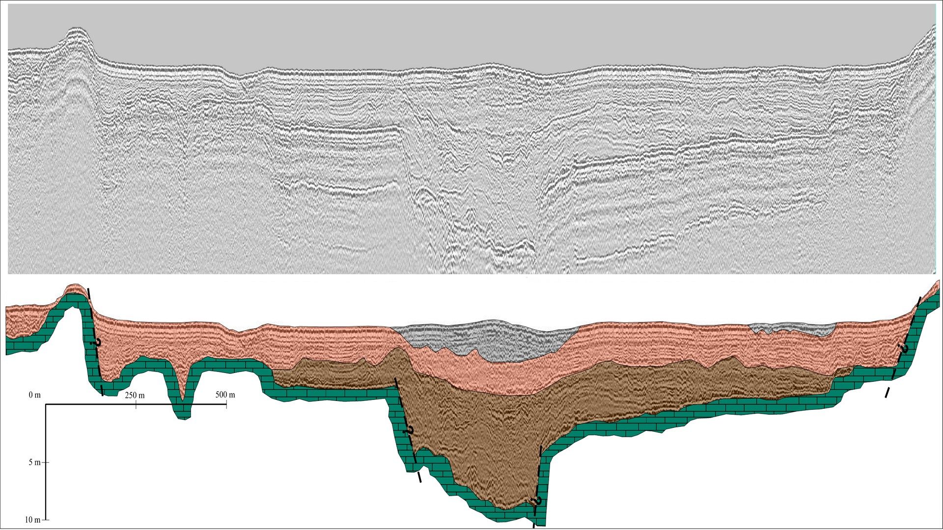
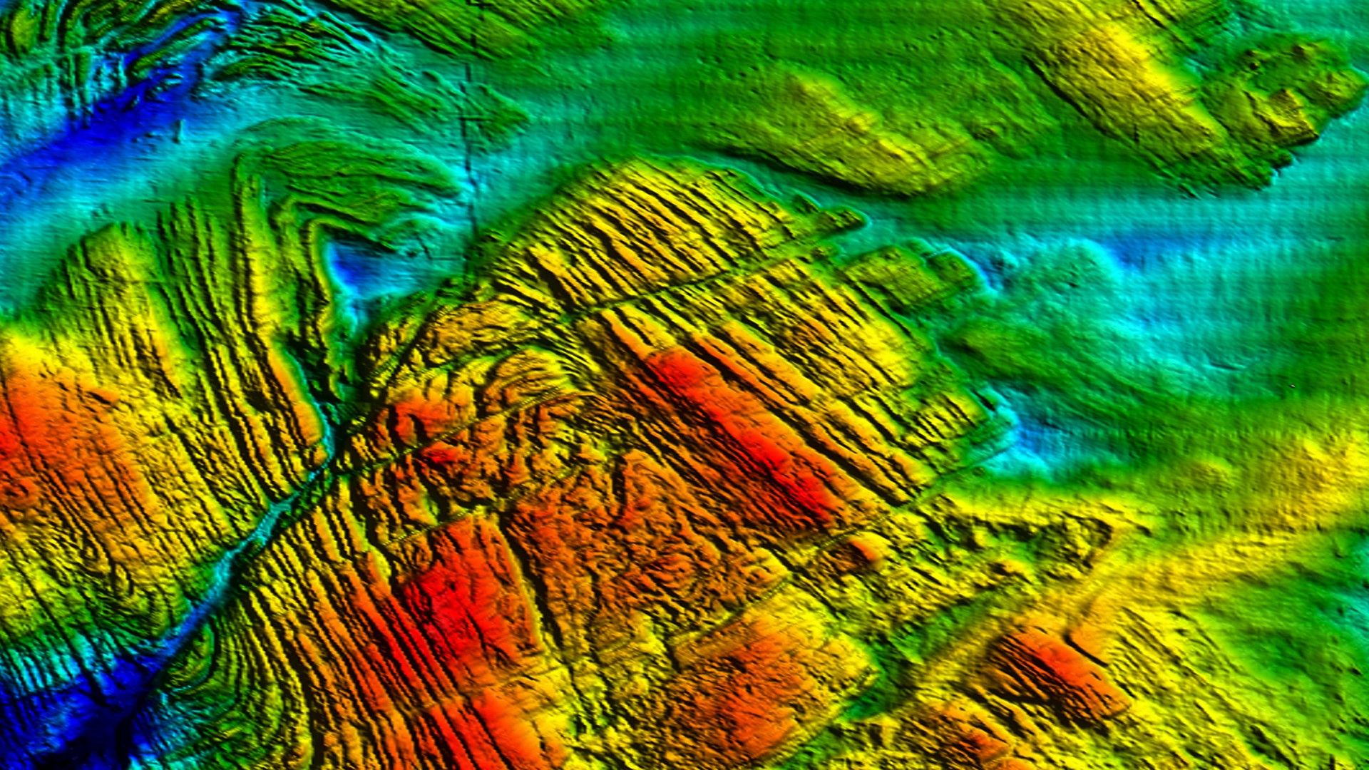
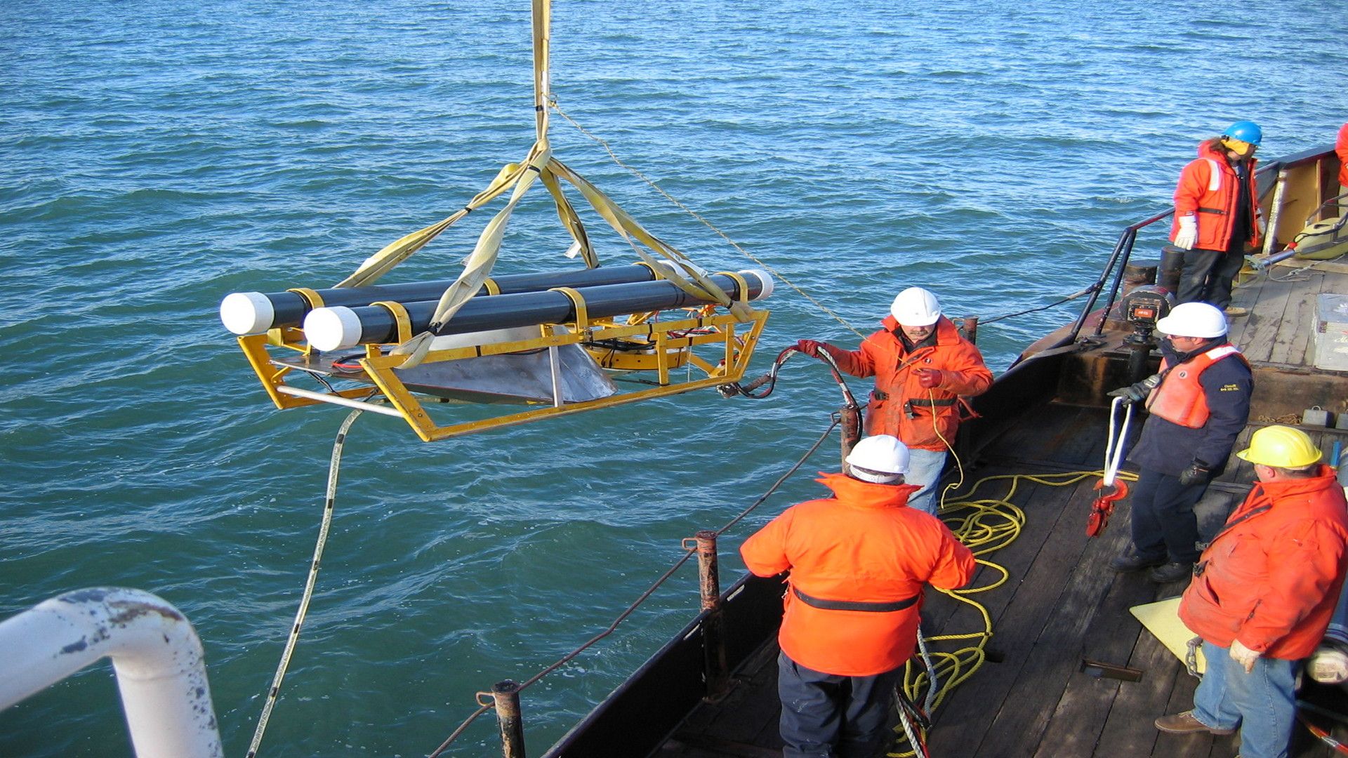
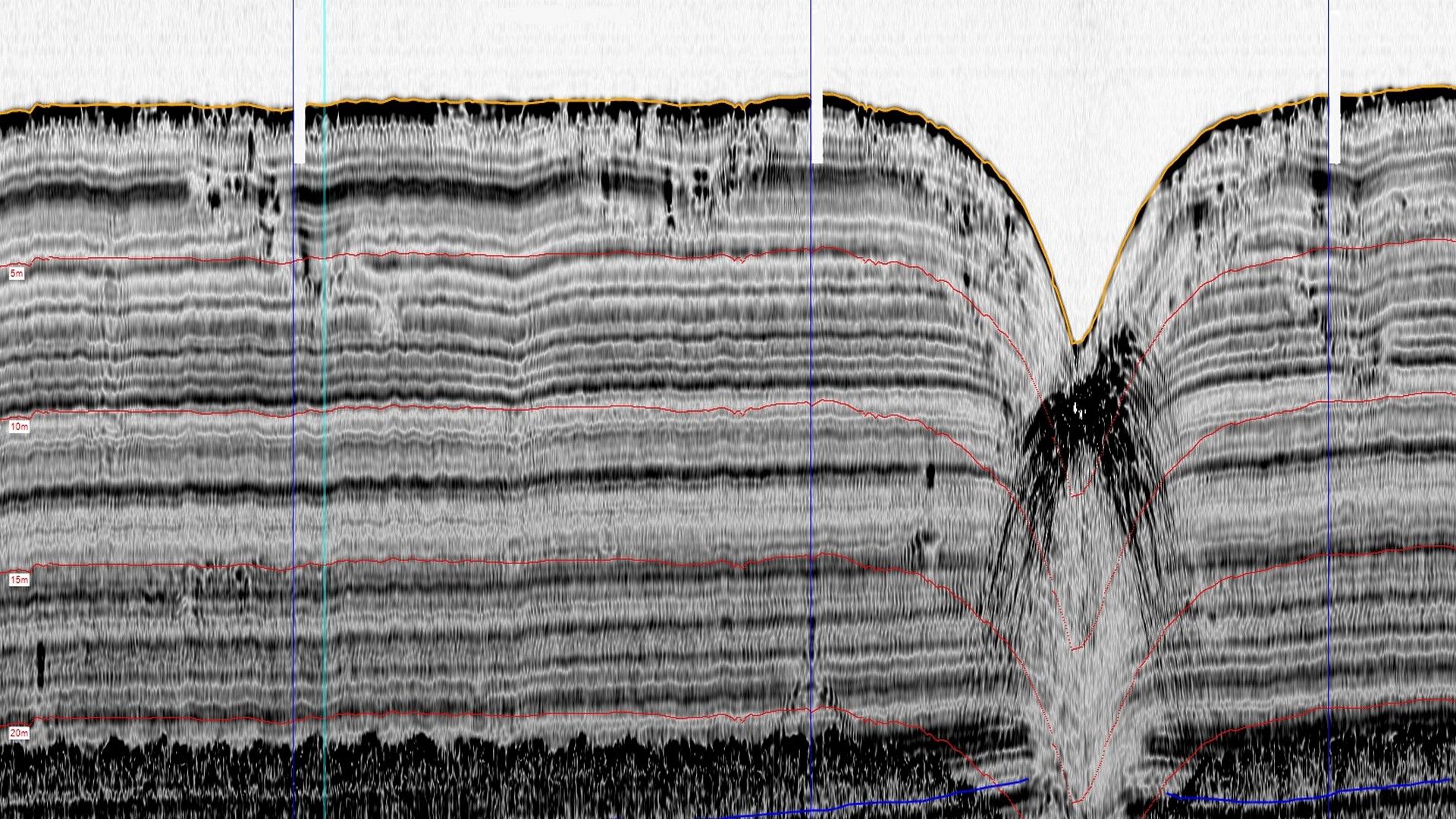
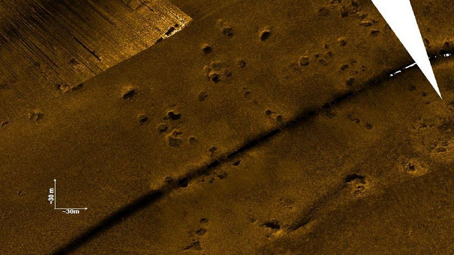
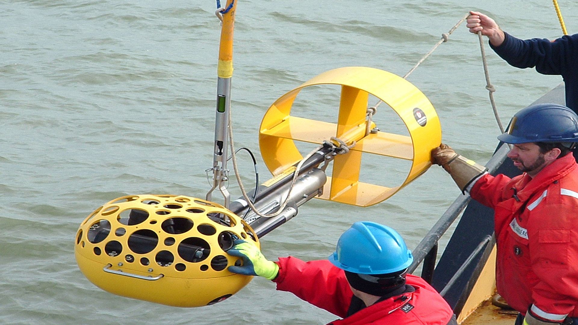
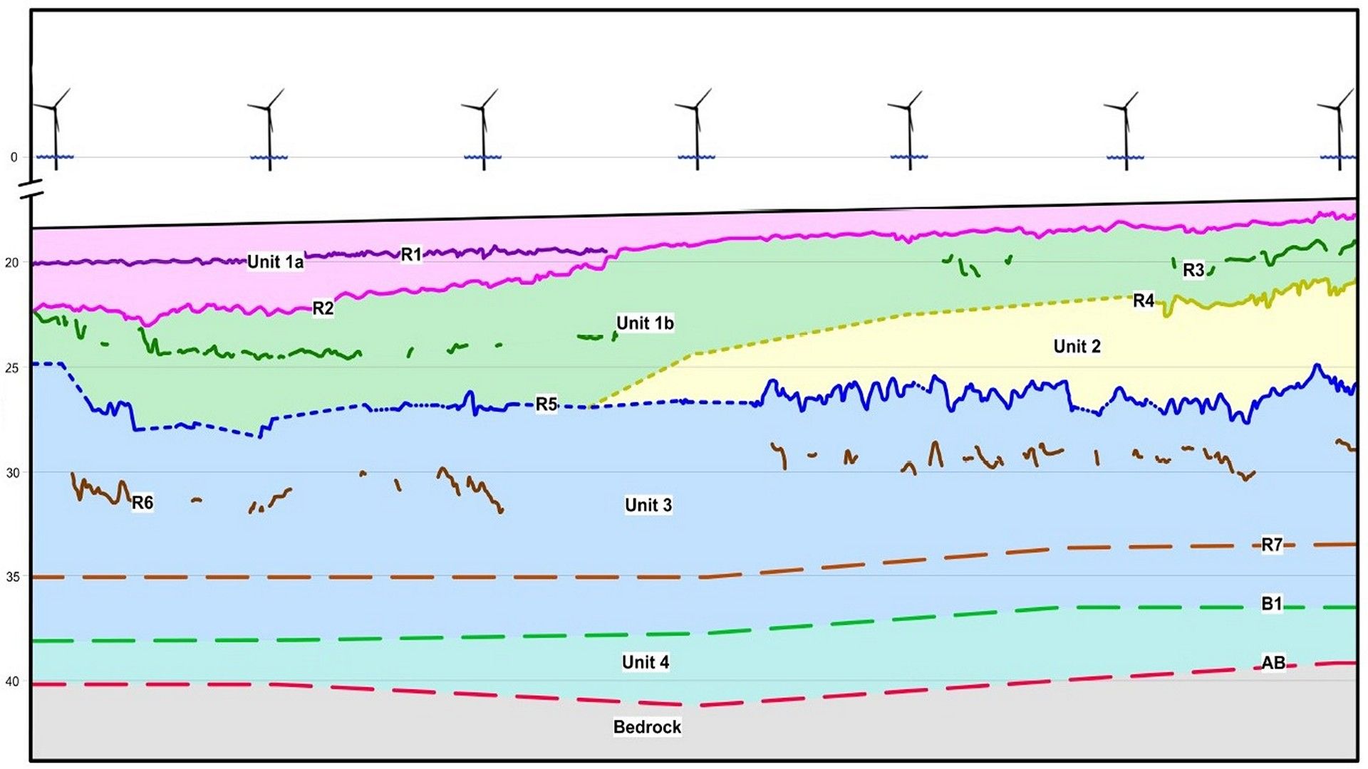
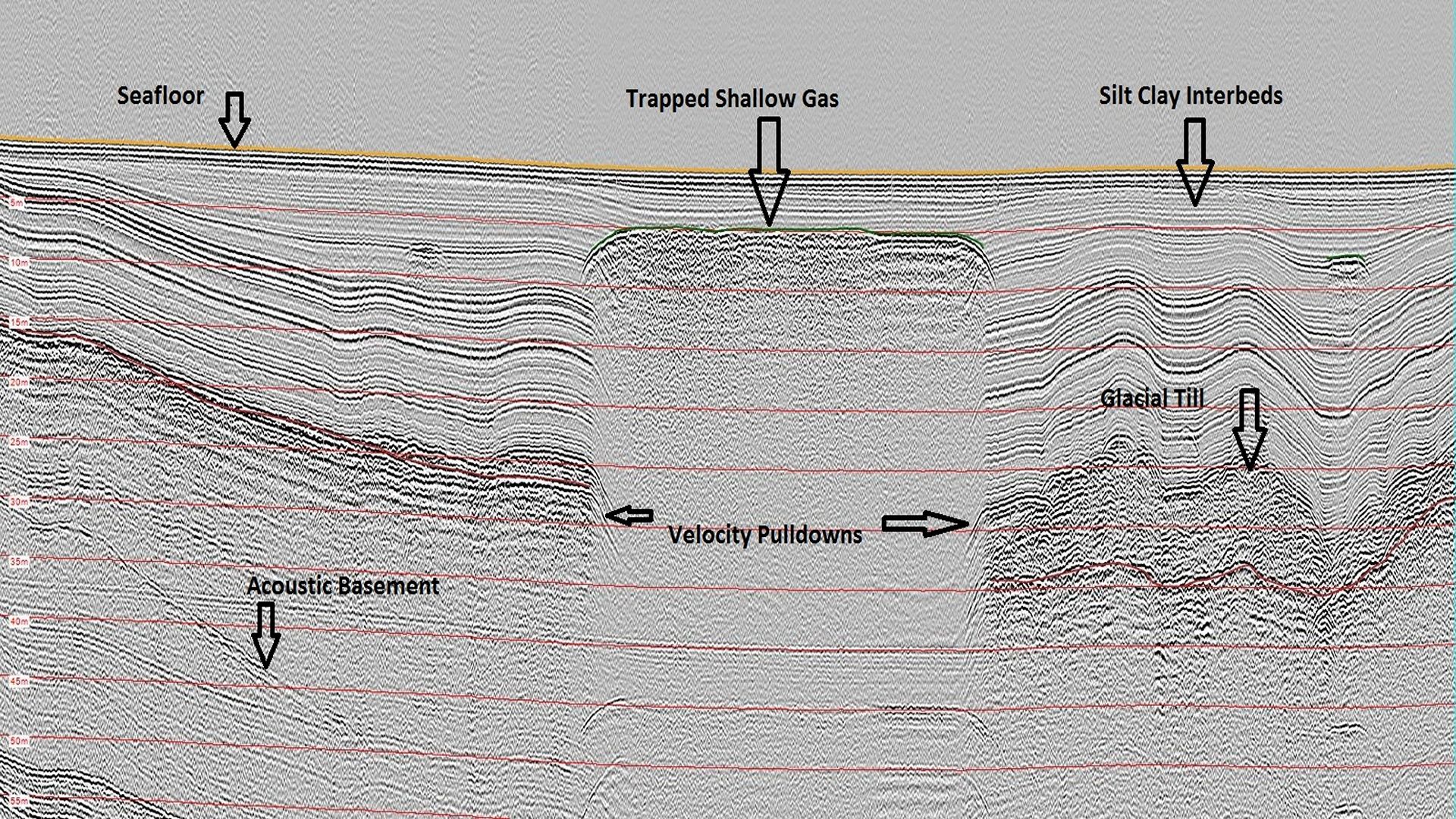
CSR specializes in conducting multibeam echosounder and sidescan sonar surveys to obtain accurate and detailed information on the topography of the seafloor, including bathymetry, surficial geology, and bottom obstructions, to assist with turbine placement and cable routing. We employ sub-bottom profiler, single and multichannel seismic, and marine refraction techniques to map the subsurface stratigraphy and identify geological hazards, such as faults or gas pockets, that may impact the turbine installation and anchoring process. We ground truth our geophysical data through the processing and testing of geotechnical samples, collected using vibracore, drop corer, or grab sampling methods.
We provide our clients with detailed information on the seabed and sub-surface conditions to assist in the planning, engineering design, installation, and assessment of renewable energy installations. Our services allow developers and engineers to make informed decisions, optimize the design and construction process, and mitigate risks associated with nearshore and offshore renewable energy projects.
- Desktop Studies
- Pre-Construction Site Investigations
- Cable Route Surveys
- Depth to Bedrock Mapping
- Geotechnical & Enviromental Sampling
- Ice Scour Assessments & Monitoring
- High Resolution Debris Surveys
- Unexploded Ordnance (UXO) Surveys
- Post-Construction Inspections & Monitoring
Gallery
- Overview
- Pipeline & Cable Routing
- Dredging Support
- Navigation Safety & Charting
- Renewable Energy Developments
- Ghost Gear Locate & Recovery
- Ice Scour Mapping & Analysis
- Construction & Engineering Support
- Coastal Zone Mapping
- Port & Harbour Developments
- Geotechnical Investigations
- Environmental Mapping & Monitoring