Dredging Support
CSR GeoSurveys Ltd. has extensive experience in conducting hydrographic and marine geophysical surveys in support of dredging and seabed levelling projects. We have provided dredging support services for port and harbour developments, navigation channel maintenance, land reclamation and environmental remediation projects, pipeline and cable route trenching, and artificial island developments.
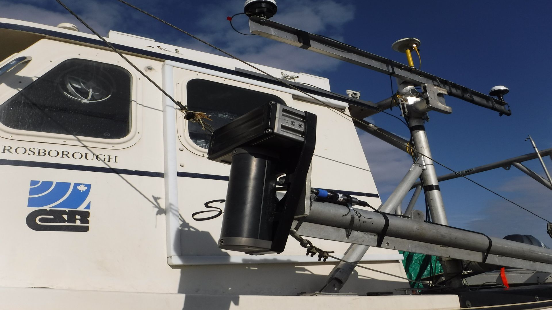
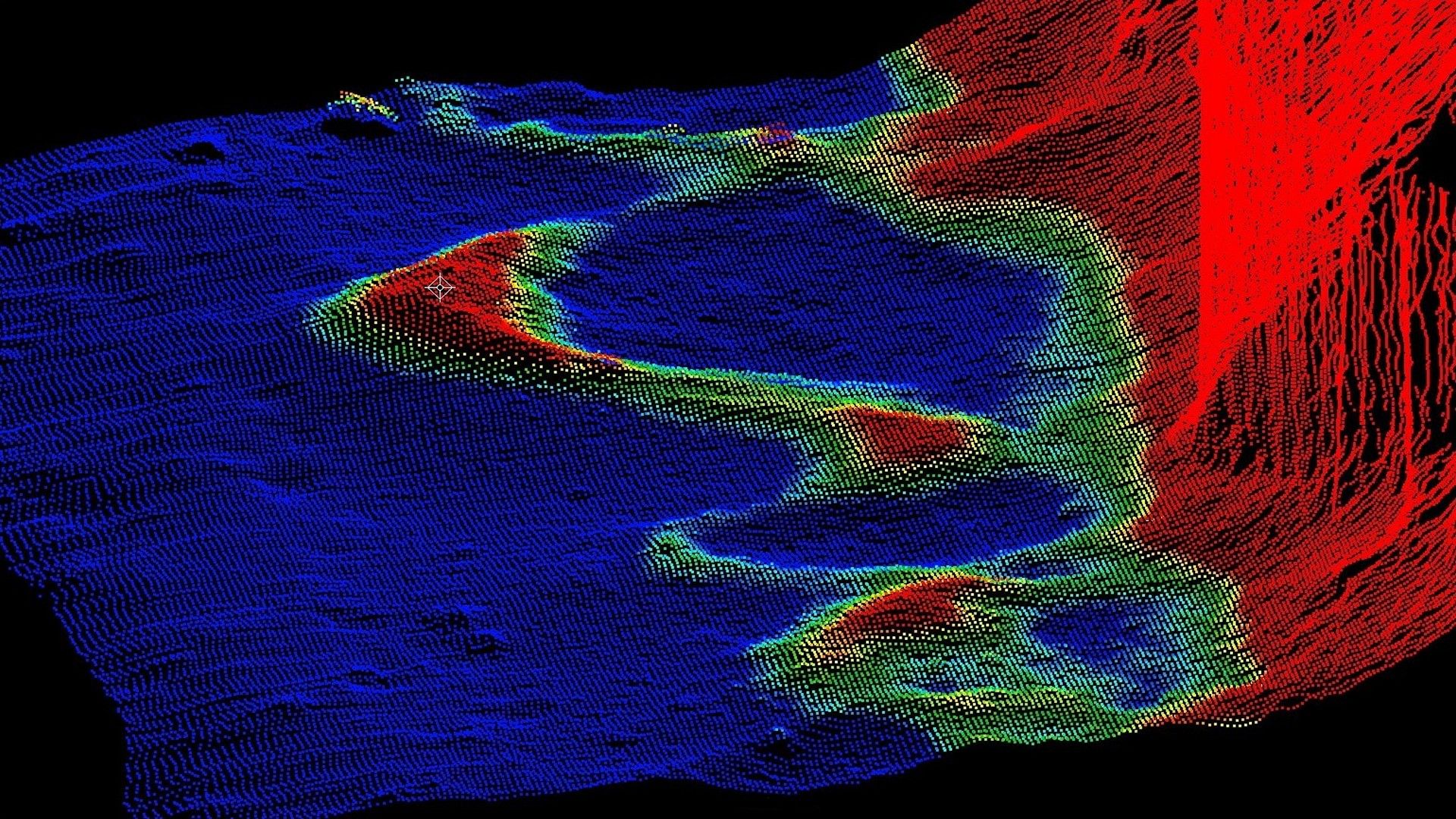
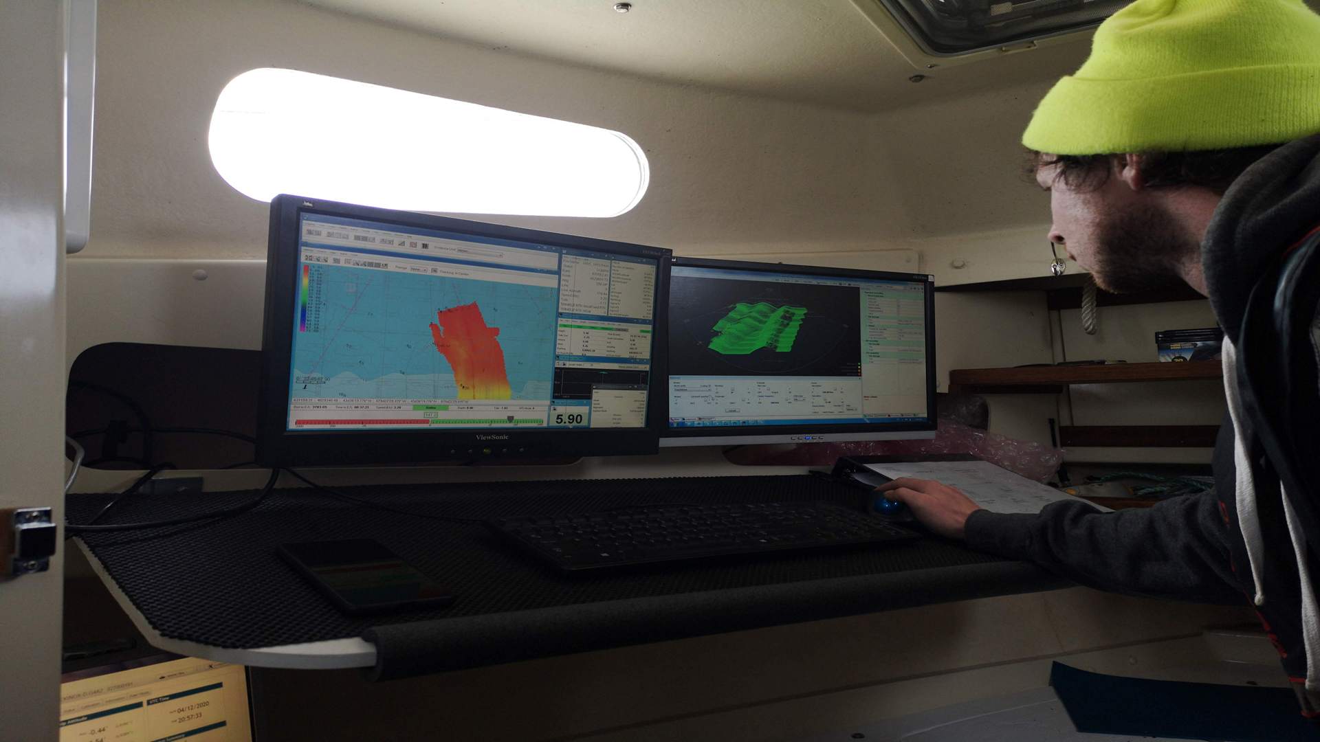
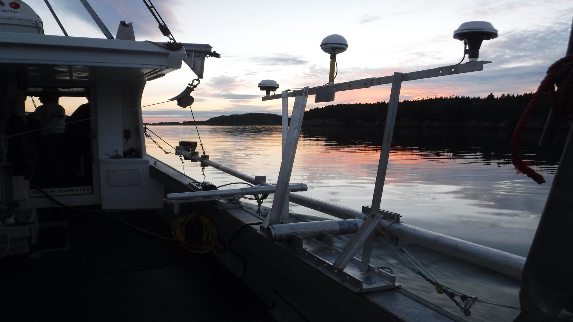
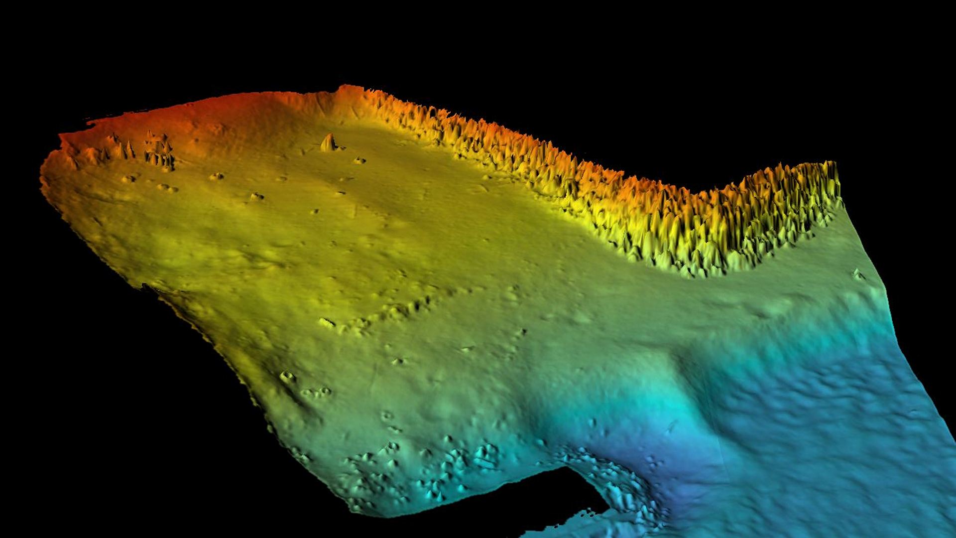
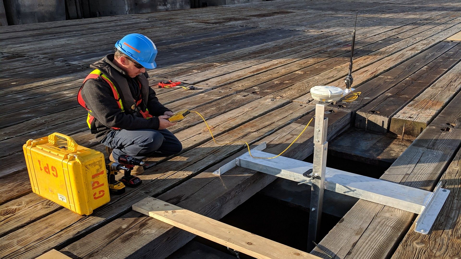
With our experienced personnel and advanced survey equipment, CSR is capable of undertaking a wide range of dredging support services, including pre-dredge, post-dredge, and interim surveys, for both capital and maintenance projects. Utilizing multibeam echosounder technology, interfaced with real-time kinematic (RTK) positioning and motion sensor data, we obtain precise depth measurements for monitoring dredging activities. We provide our clients with baseline bathymetry data, detailed sediment volume calculations, and identify areas of accretion or erosion to assist with the planning of dredging projects and ensure design objectives are achieved.
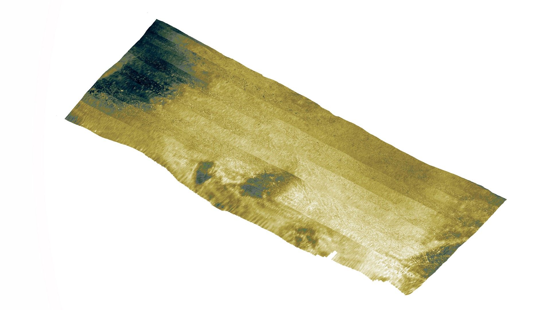
CSR offers dredging support services in any environment, including coastal regions, congested harbours, and navigation channels, with 24/7 support available where required. If further information on sediment types, subsurface geology, or seabed hazards are required over the dredging site, we can also employ sidescan sonar, magnetometer, sub-bottom profiler, and geotechnical sampling techniques.
- Pre-Dredge Surveys
- Post-Dredge Surveys
- 24/7 Dredge Monitoring Support
- Dredge Volume Analysis
- Geotechnical & Environmental Sampling
Gallery

- Overview
- Pipeline & Cable Routing
- Dredging Support
- Navigation Safety & Charting
- Renewable Energy Developments
- Ghost Gear Locate & Recovery
- Ice Scour Mapping & Analysis
- Construction & Engineering Support
- Coastal Zone Mapping
- Port & Harbour Developments
- Geotechnical Investigations
- Environmental Mapping & Monitoring