HVDC Submarine Power Cable Project
CSR GeoSurveys Ltd. completed a comprehensive desktop study, hydrographic survey, marine geophysical investigation, and a geotechnical exploration program for a high-voltage direct current (HVDC) submarine cable project in The Great Lakes. The proposed cable route extended approximately 104 km along the lakebed of Lake Erie between Nanticoke, Ontario and Springfield, Pennsylvania.
Desktop Route Assessment
CSR completed a preliminary desktop routing assessment to evaluate potential submarine cable corridors across Lake Erie. The study included the review and interpretation of available bathymetric, geological, and environmental datasets to identify optimal routing solutions and potential engineering constraints.
The cable route assessment considered:
- Lakebed bathymetry and geomorphology
- Regional and surficial geology
- Potential geohazards and seabed constraints
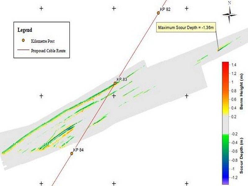
- Ice scour susceptibility
- Existing obstructions and infrastructure
- Commercial navigation and marine activity
The desktop study provided the basis for planning the subsequent marine surveys and geotechnical investigation programs.
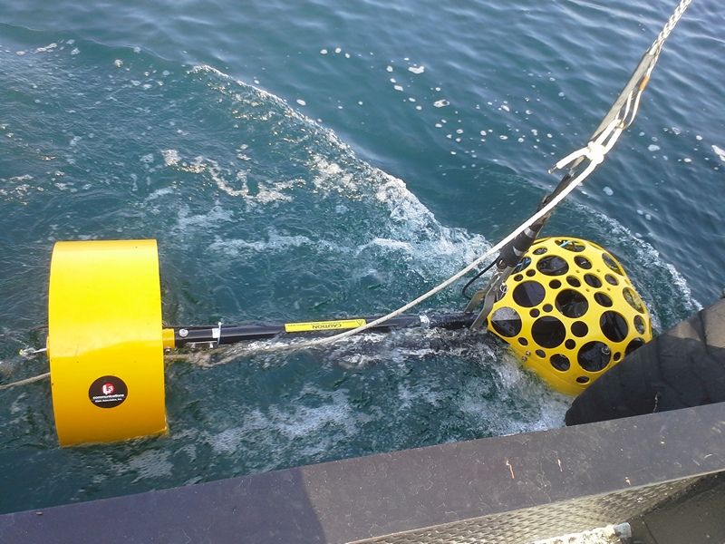
Hydrographic & Marine Geophysical Surveys
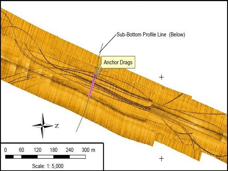
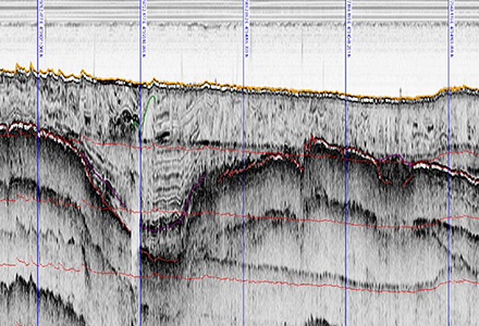
CSR conducted high-resolution hydrographic and marine geophysical surveys along the preliminary cable route corridor using:
- Chirp sub-bottom data (Klein 3310 Chirp)
- Boomer reflection sub-bottom data (Surface Tow/CSP-P 350J)
- Sidescan sonar data (Klein 3000)
- Marine magnetometer data (Marine Magnetics SeaSpy)
- Multibeam echosounder data (Odom MB1)
- Dual frequency single beam echosounder (Odom CV3)
- Nearshore video transects
These surveys provided detailed information on:
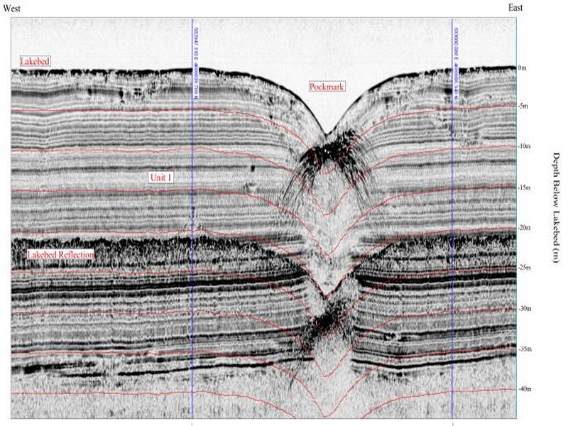
- Lakebed bathymetry
- Surficial sediment distribution
- Subsurface geological conditions
- Geological hazards, including shallow gas and ice scours
- Shipwreck and obstruction locations
- Existing subsea infrastructure and pipeline crossings
The survey data supported route optimization, engineering design, installation planning, and permitting requirements for the proposed submarine cable system.
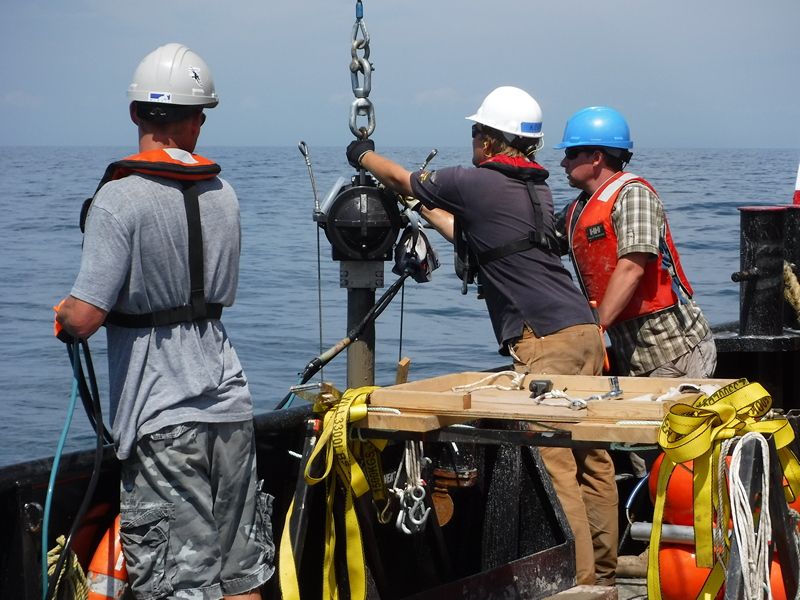
Geotechnical Investigation Program
Following the completion of the hydrographic and geophysical surveys, CSR carried out a comprehensive geotechnical exploration and sampling program consisting of:
- 62 vibracore samples (5 m core length)
- 36 in situ thermal resistivity test locations
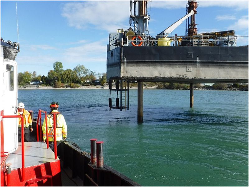
- 8 boreholes completed at landfall sites using a jack-up barge and track mounted auger drill
- 10 nearshore grab samples
Field investigations included sample collection, onboard testing and logging, and laboratory analysis to characterize subsurface conditions and support cable burial and thermal performance assessments.
Gallery
Project Management & Execution
CSR managed and directed a large scale, multidisciplinary offshore investigation program throughout the duration of the project. Responsibilties included coordination of:
- 5 marine vessels
- 7 subcontractors
- A jack-up barge operation
- Over 30 project personnel
The completed investigations provided critical engineering and environmental information required for final cable routing, detailed design, installation planning, and regulatory permitting in both Canada and the United States.
- Port Development Project, Montserrat
- Chukchi Shelf Regional Studies
- Submarine Cable Reinforcement Project
- Offshore Wind Turbine Project
- HVDC Submarine Power Cable Project
- Submarine Pipeline Project
- Sea of Okhotsk (Russian Arctic)
- Route Assessment Project, Chukchi Sea
- Resolute Bay (Canadian Arctic)
- Hydrographic Surveys, Halifax Harbour
- Wind Farm Submarine Cable Route
- Artificial Island Sediment Mobility Projects, Beaufort Sea