Submarine Cable Reinforcement Project
CSR GeoSurveys Ltd. was contracted to conduct hydrographic, marine geophysical, and topographic surveys for a proposed submarine cable reinforcement project in the Bay of Fundy. The project involved the replacement of an existing 20 MW, 69 kV AC three-core submarine cable installed between two marine passages.
CSR surveyed two proposed submarine cable corridors totaling approximately 3.5 km and 16.3 km in length to support the engineering design and installation planning for the reinforcement cables.
Hydrographic & Marine Geophysical Surveys
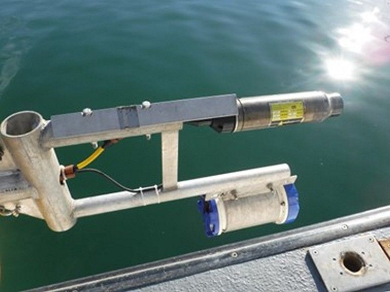
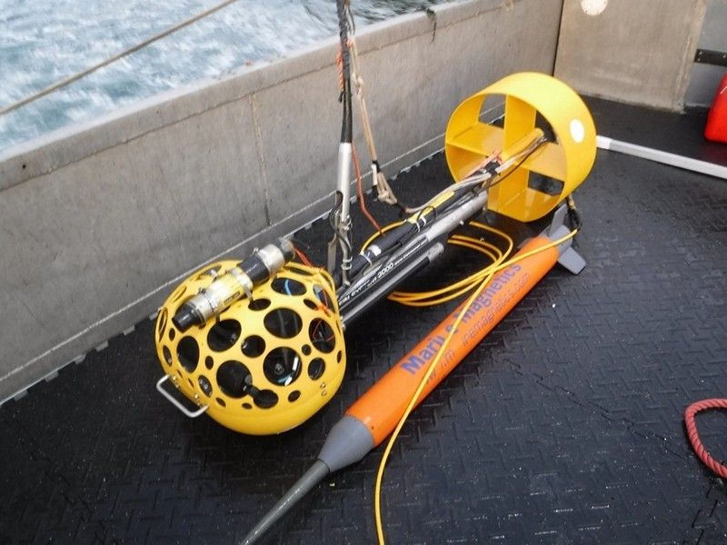
CSR completed detailed hydrographic and marine geophysical investigations along the proposed cable route corridors utilizing a suite of survey systems, including:
- Multibeam echosounder
- Sidescan sonar
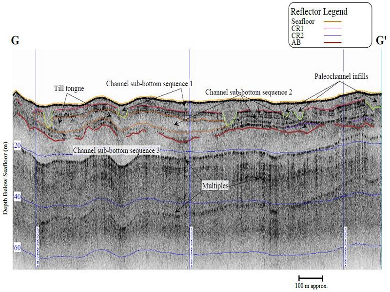
- Chirp sub-bottom profiler
- Marine magnetometer
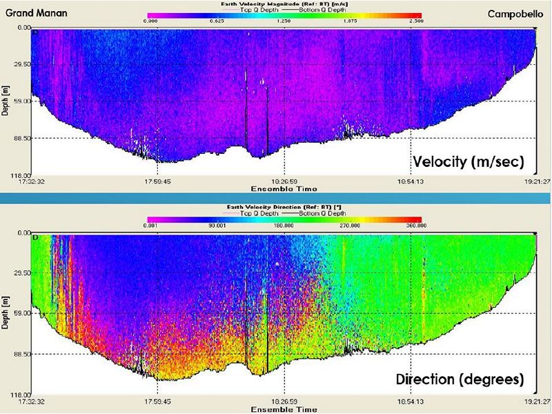
- Acoustic Doppler current profiler (ADCP)
- Seabed grab sampler
The marine surveys provided information on:
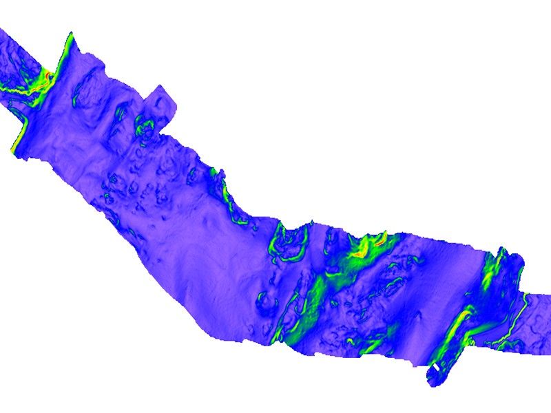
- Seafloor bathymetry
- Surficial sediment characterization
- Subsurface geology characterization
- Potential cable installation hazards and route constraints
- Surface and buried ferrous debris
- Local current speed and direction
- Ground truthed surficial geology interpretations
This information was used to support route selection, cable burial assessments, and installation feasibility analyses.
Topographic Surveys
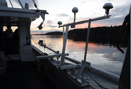
Conventional land surveys were completed using RTK-GPS between the existing cable terminal stations and proposed landfall locations. The topographic survey program included:
- Measurement of topographic elevations
- Identification of natural and manmade features
- Delineation of legal property boundaries
- Mapping of roads and rights-of-way
- Identification of buried utilities within landfall easements
- Surveying of the Ordinary High Water Mark (OHWM) at each landfall site.
Permanent survey control monuments were also established at each existing cable terminal station to support future engineering and construction activities.
Project Outcome
The integrated hydrographic, marine geophysical, and topographic datasets provided critical information required for the detailed engineering design, route optimization, and installation planning of the proposed submarine cable reinforcement system in the Bay of Fundy.
Gallery
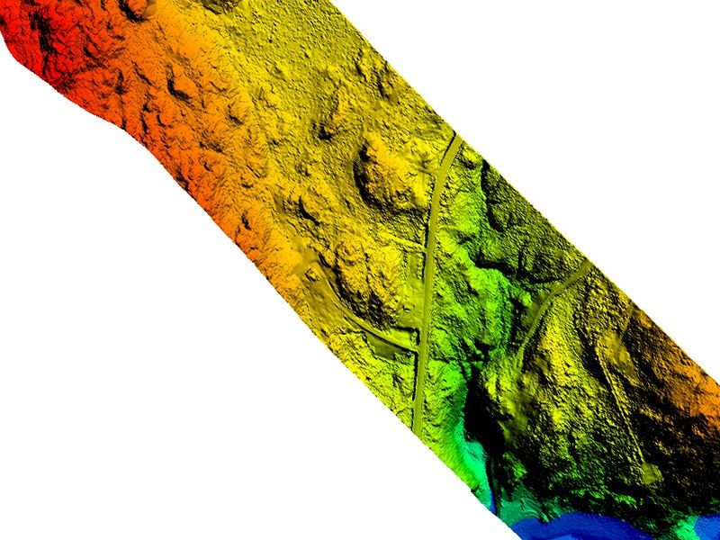
Topo-Bathymetric LiDAR
An airborne topo-bathymetric LiDAR survey was conducted to acquire high resolution elevation data across the onshore and shallow nearshore portions of the cable route corridors. The LiDAR dataset was merged with the offshore multibeam bathymetric data to create a seamless elevation model extending from the landfall sites into the offshore marine corridor.
- Port Development Project, Montserrat
- Chukchi Shelf Regional Studies
- Submarine Cable Reinforcement Project
- Offshore Wind Turbine Project
- HVDC Submarine Power Cable Project
- Submarine Pipeline Project
- Sea of Okhotsk (Russian Arctic)
- Route Assessment Project, Chukchi Sea
- Resolute Bay (Canadian Arctic)
- Hydrographic Surveys, Halifax Harbour
- Wind Farm Submarine Cable Route
- Artificial Island Sediment Mobility Projects, Beaufort Sea