Resolute Bay (Canadian Arctic)
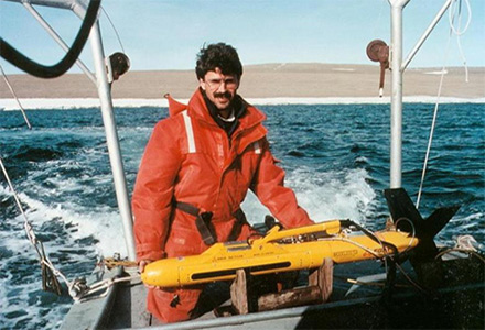
CSR conducted five consecutive years of repetitive ice scour mapping offshore Resolute in the high Canadian Arctic for the Geological Survey of Canada. Regional and detailed grids were surveyed to determine new scour impact rates and scour process information. Sidescan sonar data were correlated with ground truth obtained by diving operations.
Gallery
/Resolute-Bay-4.jpg)
/Resolute-Bay-3.jpg)
/Resolute-Bay-2.jpg)
/Resolute-Bay-1.jpg)
Acoustic signature of scours recorded by the sonar correlated with biological recolonization rates in scoured areas to enhance CSR's acoustic scour degradation classification.
- Port Development Project, Montserrat
- Chukchi Shelf Regional Studies
- Submarine Cable Reinforcement Project
- Offshore Wind Turbine Project
- HVDC Submarine Power Cable Project
- Submarine Pipeline Project
- Sea of Okhotsk (Russian Arctic)
- Route Assessment Project, Chukchi Sea
- Resolute Bay (Canadian Arctic)
- Hydrographic Surveys, Halifax Harbour
- Wind Farm Submarine Cable Route
- Artificial Island Sediment Mobility Projects, Beaufort Sea