Marine Geophysical Surveys
Our Marine Geophysical Surveys include; precise positioning, hydrographic surveying, seafloor imaging, sub-bottom profiling, geotechnical analysis as well as comprehensive reporting and mapping.
CSR's geophysical systems enable us to offer a wide variety of services to our clients.
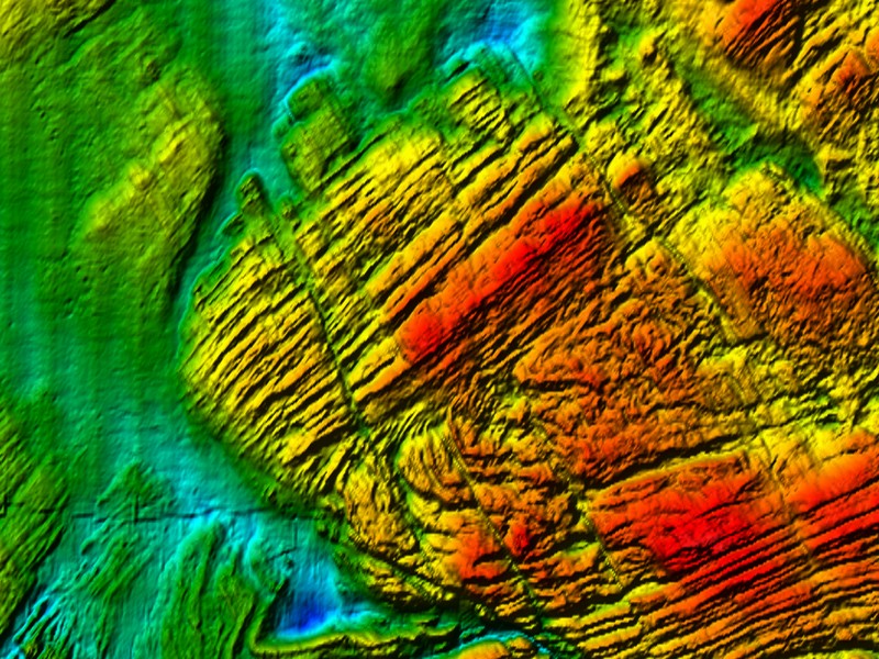
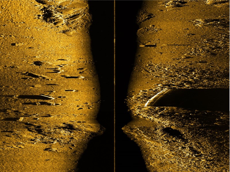
- Sidescan sonar technology allows us to achieve high resolution seabed imagery for geo-hazard detection.
- Single and Multibeam sounding systems achieve the highest quality bathymetric data for hydrographic, engineering, and routing applications.
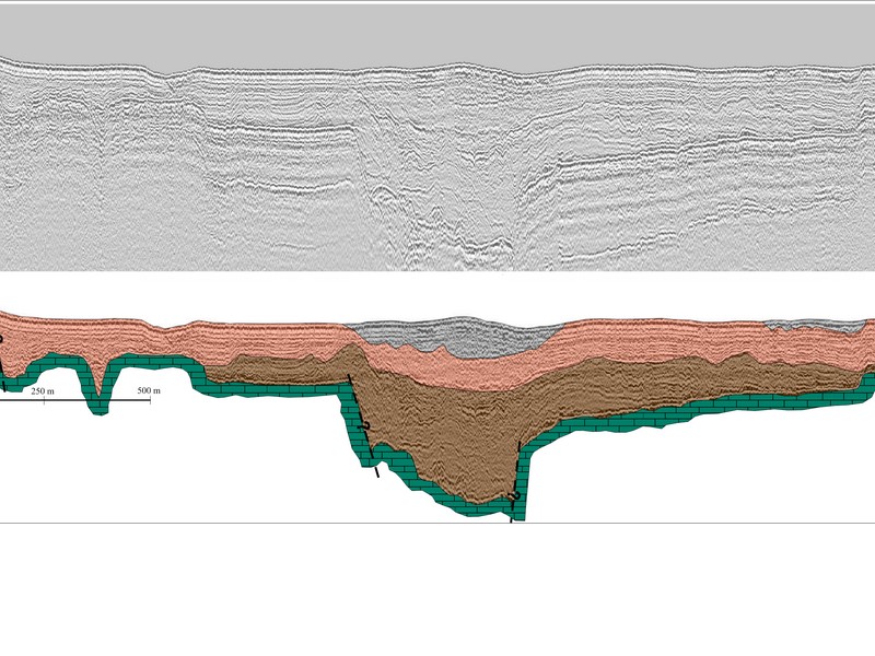
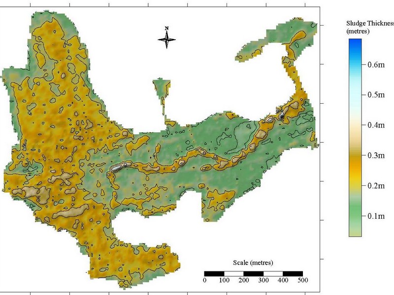
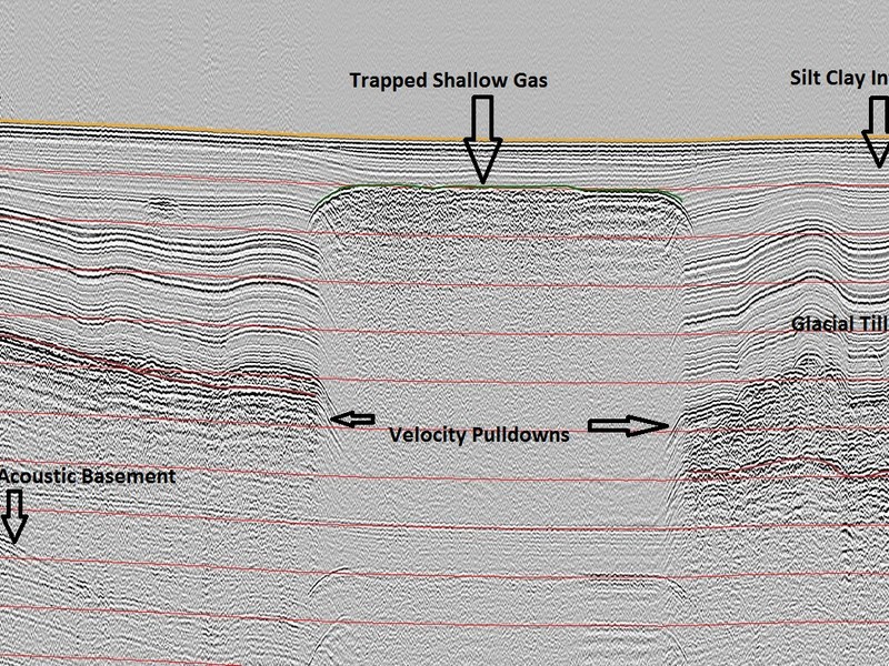
- Seismic Reflection and Refraction profiling systems are used to accurately map depth to bedrock and surficial sediments.
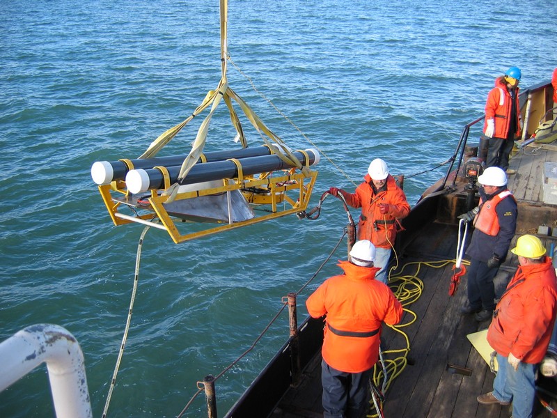
- Marine Magnetometers map the ferrous nature of seafloor targets.
- Marine EM61 systems for UXO detection.
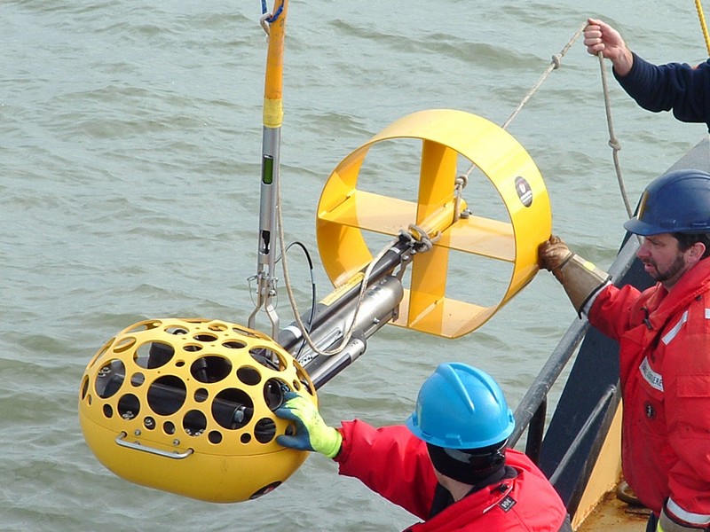
- Geotechnical cores, Underwater video and ROV for ground truth applications.
Over the last 35 years, CSR has conducted 100’s of Geophysical surveys in many diverse and often challenging regions of our planet. We take pride in understanding our clients requirements often designing and building equipment to suit their needs. We also understand the complexities of our business! Therefore we often utilize multi-sensor techniques to enhance and correlate the responses we obtain from the subsurface environment.
Data processing, interpretation, mapping and reporting is a Key element of the CSR Project Life Cycle. Highly experienced, senior staff use the latest software and processing technologies to create final charts, figures and reports to the highest of standards in the Marine Industry.
Gallery

- Overview
- Pipeline & Cable Routing
- Dredging Support
- Navigation Safety & Charting
- Renewable Energy Developments
- Ghost Gear Locate & Recovery
- Ice Scour Mapping & Analysis
- Construction & Engineering Support
- Coastal Zone Mapping
- Port & Harbour Developments
- Geotechnical Investigations
- Environmental Mapping & Monitoring